
About The Product
Target Users
Developers, GIS and IT teams needing to test, monitor and visualize geospatial APIs
Pain Points
Difficulty in testing, monitoring, and visualizing geospatial APIs in one place.
Key Features
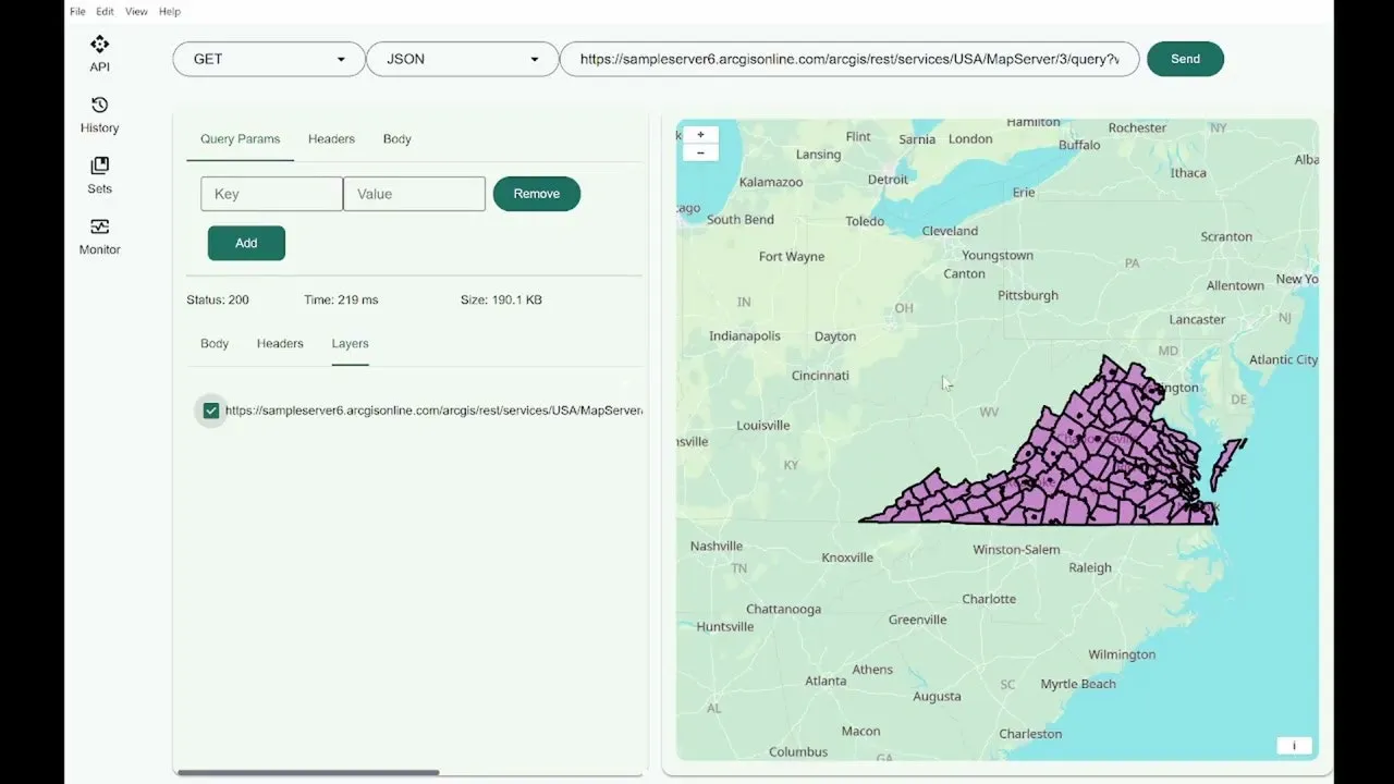
- Quetzly enables testing, monitoring, and visualization of geospatial APIs in one platform, allowing adjustment of HTTP requests, headers, and query parameters with an integrated JSON editor.
- It renders WMS, WFS, GeoJSON, and ArcGIS services on an interactive map, supporting layer toggling, extent zooming, and data export as GeoJSON or Shapefile.
- The tool tracks endpoint health to minimize downtime and ensure reliable location services for developers, GIS, and IT teams.
- Quetzly is a developer tool currently in open Beta, offering free access for users to test its geospatial API management capabilities.
Launch Date
Verified Listing
Vetted manually by Domainay team.
Categories
Maker
Secret Maker
Indie Developer
Similar Products
Verdent
Your AI-native partner for the new way to build software
MiroMiro
Copy any website's design & assets in one click
Ultracite v7
Opinionated, zero-config code linter and formatter
Blober.io
The easiest way to transfer files between cloud providers.
LocalMark Studio
A fast, local-first Markdown editor for real work.
TranslateGemma
Open translation on Google models, supporting 55 languages
Incident/Ops
Incident management that lives where your team works
Promptsy
Create, save, and share prompts
StackPatch
Patch authentication into your Next.js app with one command
Trails
Automated insights from LLM agent runs
Building something new?
Get listed in our directory and reach 10k+ users.